AtlasBuilder™ is a GIS database management software developed for offline publishing of GIS databases and text descriptions. The program is suitable for the combined, integrated management and visual display of map data for various GIS databases (raster, vector layers, web services), as well as the related table data, images, and texts. With this program you can create maps that do not require a GIS program on digital media (CD’s, DVD’s, pen drives, and flash drives). The use of this program does not require any previous programming skills or special expertise. By combining existing data, spectacular maps can be published within a few hours.
Functionality of the program:
-
AtlasBuilder™ allows for the combination of map files of various GIS and CAD programs. It then reads, and manages the files in their native forms (without conversion)(Mapinfo: .tab, .mif, .wor; ArcGIS: .shp, .mxd, .e00, .asc, .aep; AutoCAD: .dwg, .dxf, .dlg, .txt, .jpg, .tif, .png; Erdas: .img, Lidar, etc.) and various graphical, raster, and related spreadsheet data.
-
AtlasBuilder™ builds its own geoinformatics database (SQLight) from the finished maplet, which can be opened with the resulting unique Atlas™ generated program.
-
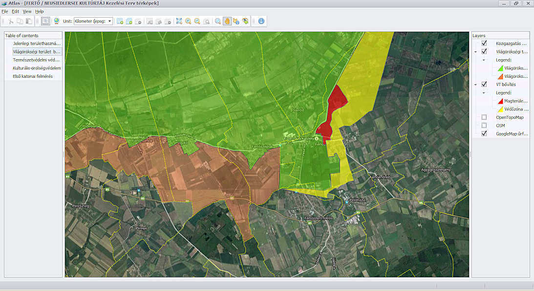
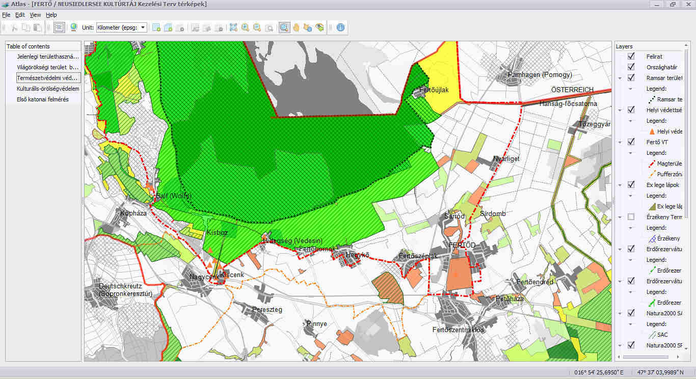
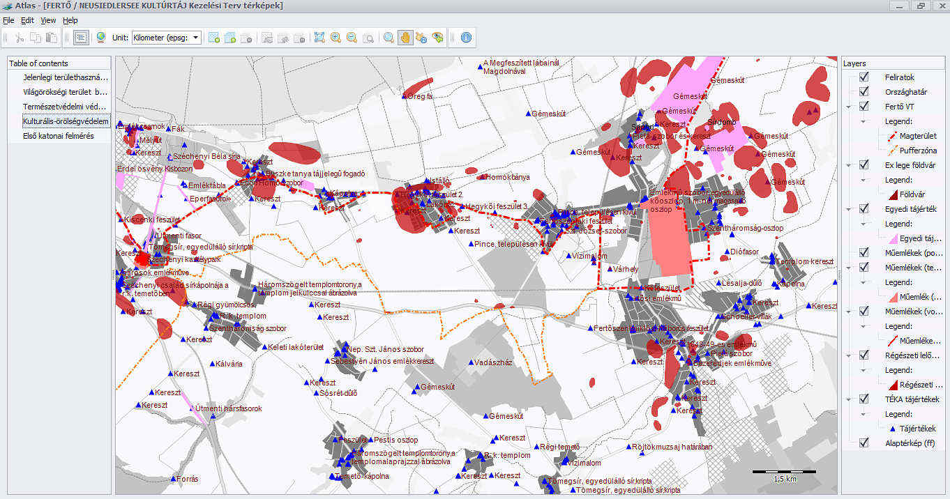
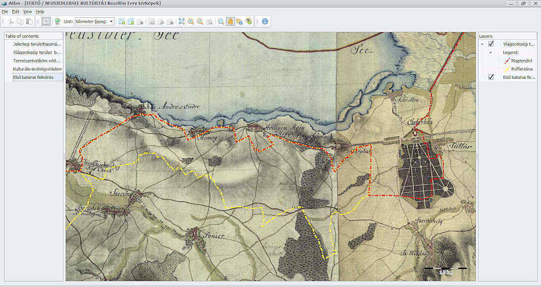
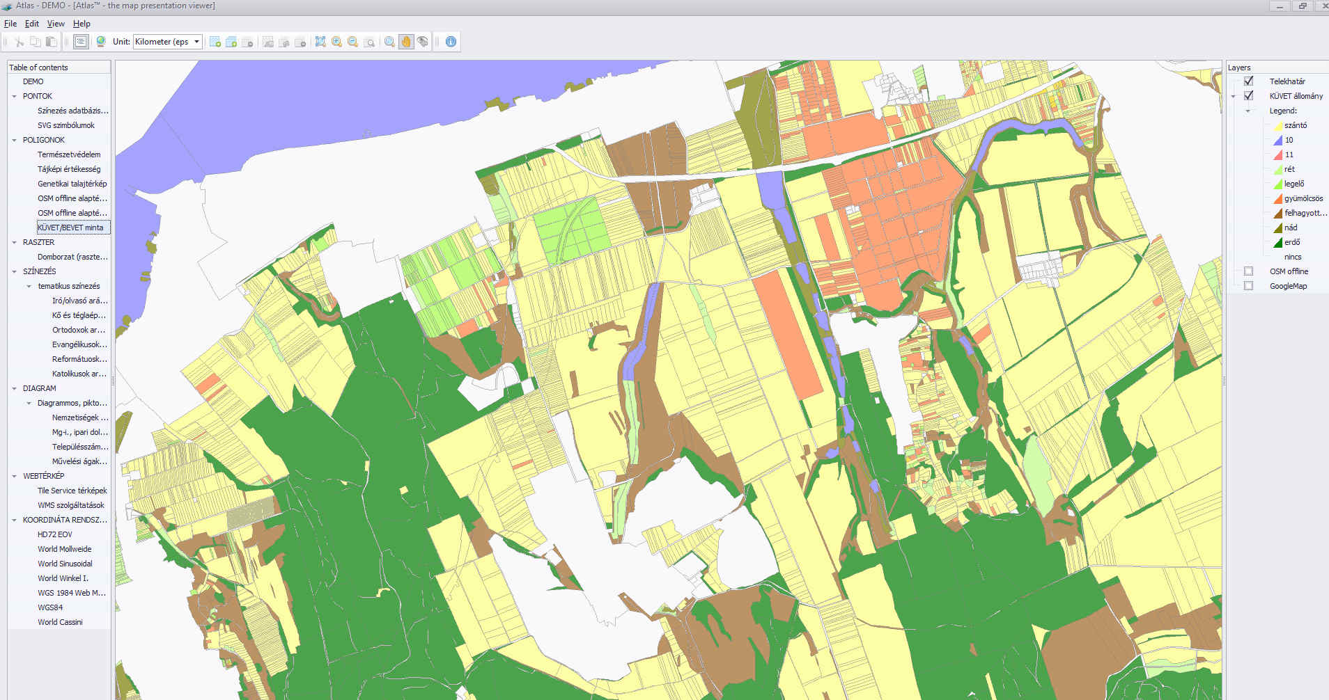
In AtlasBuilder™, you can create a table of contents using a tree structure. For each content point, a text (.rtf) document and / or map can be created.
-
These maps, just like printed publications, can be divided into individual parts and chapters, which can be handled separately.
-
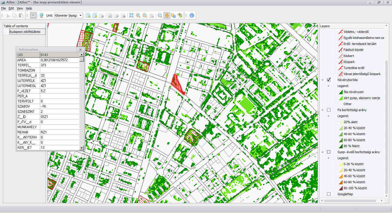
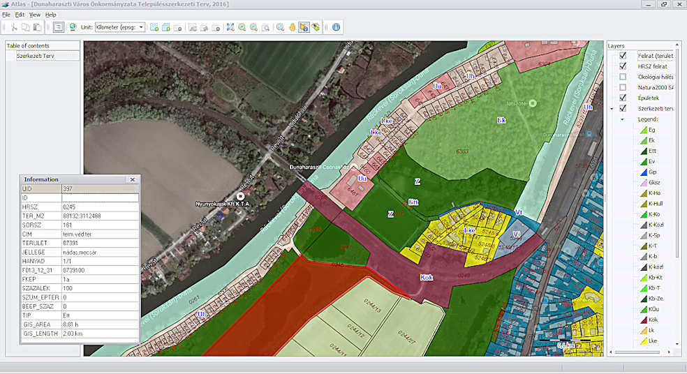
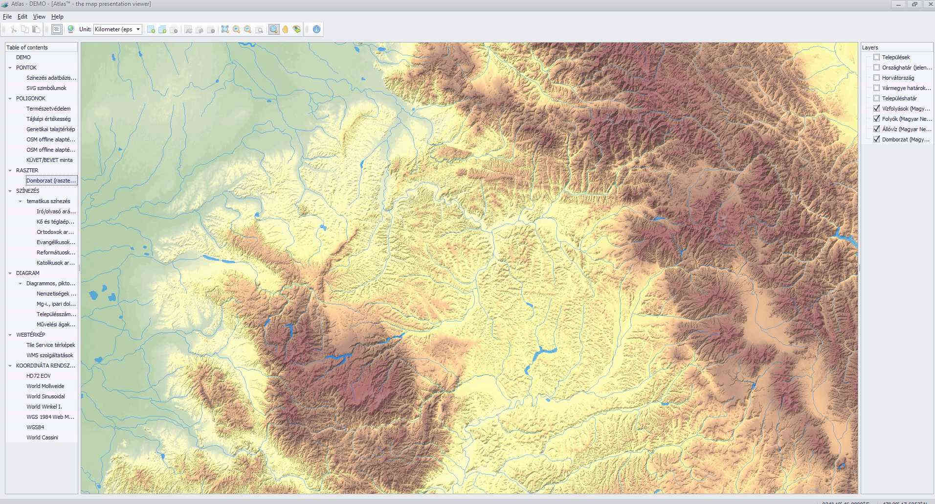
The Atlas™ program itself, along with the map, is a complex GIS application, and not just a .pdf form. Therefore it contains many GIS functions, such as layer management, querying related data, thematic coloring, amongst other functions.
-
It is possible for a user to have a CAD or GIS layer of their choice in the completed map.
-
The program recognizes more than a thousand different coordinate systems, such as WGS84, and EOV, so assembling layers of different coordinate systems in AtlasBuilder™, and later Atlas™, will not be a problem.
-
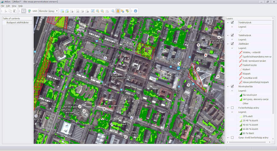
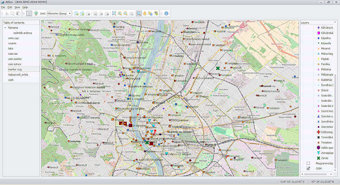
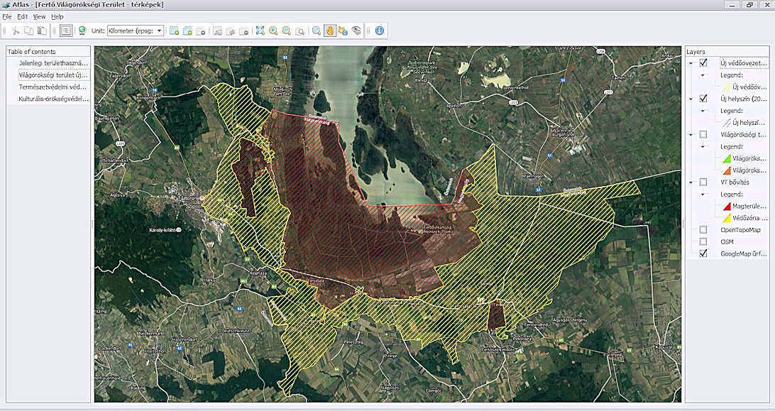
The viewer is able to use vector, raster, online (eg. GoogleMaps, Bing Maps, OpenStreetMap) and WMS services, so if our base map is not detailed enough, or hasn’t been refreshed, we can open an online based map at any time.
-
The map manager contains a detailed offline vector basic map in color and grayscale format. The map is based on the free OSM and CORINE database maps that can be published freely, without a separate license fee.
-
One of the most important aspects of map printing on external media is to replicate valuable GIS data in a protected, non-recoverable, extensible format, so the program stores all data in a unique, encrypted SQLight database for a user. The database cannot be exported, nor can it be opened in other programs. Encryption of the database is unique for each application, so each map cannot be opened with other Atlas™ programs.
-
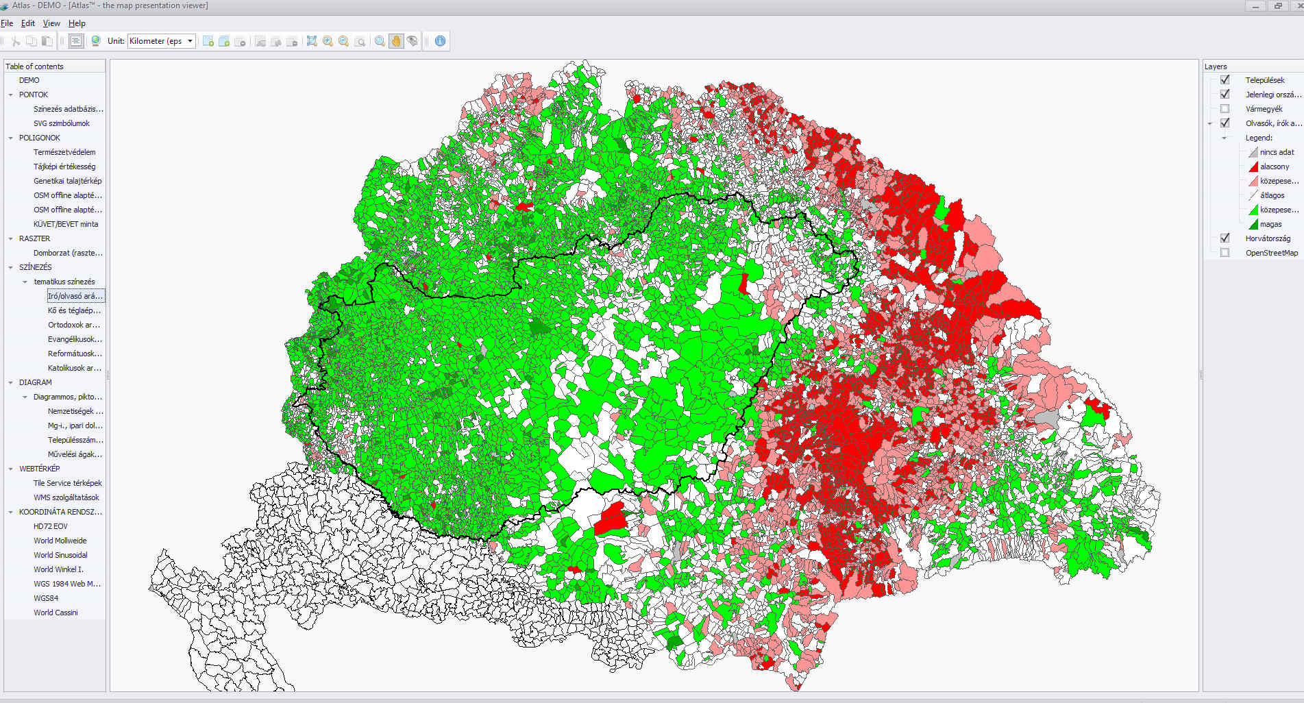
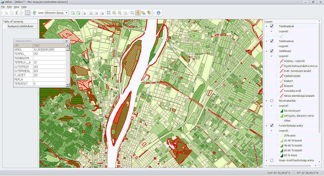
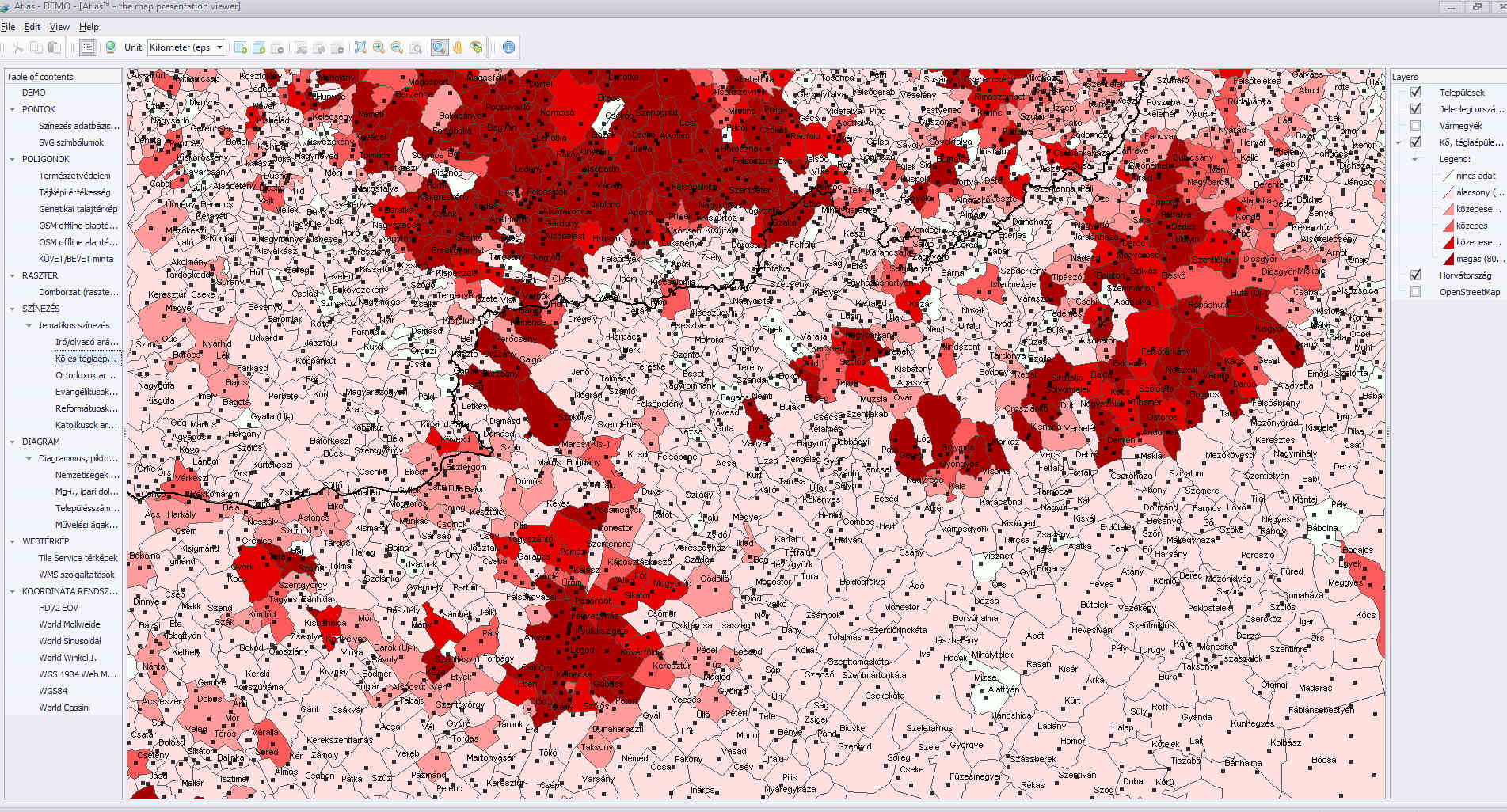
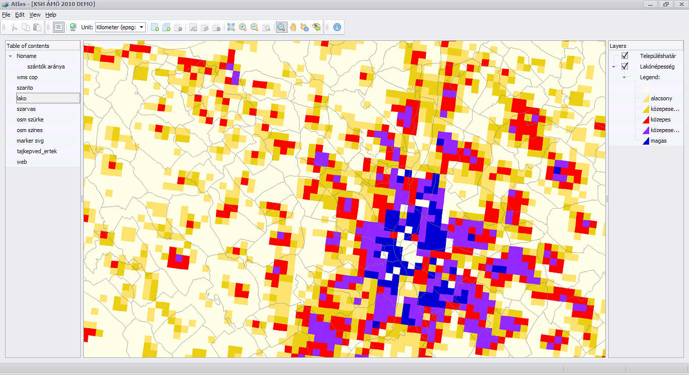
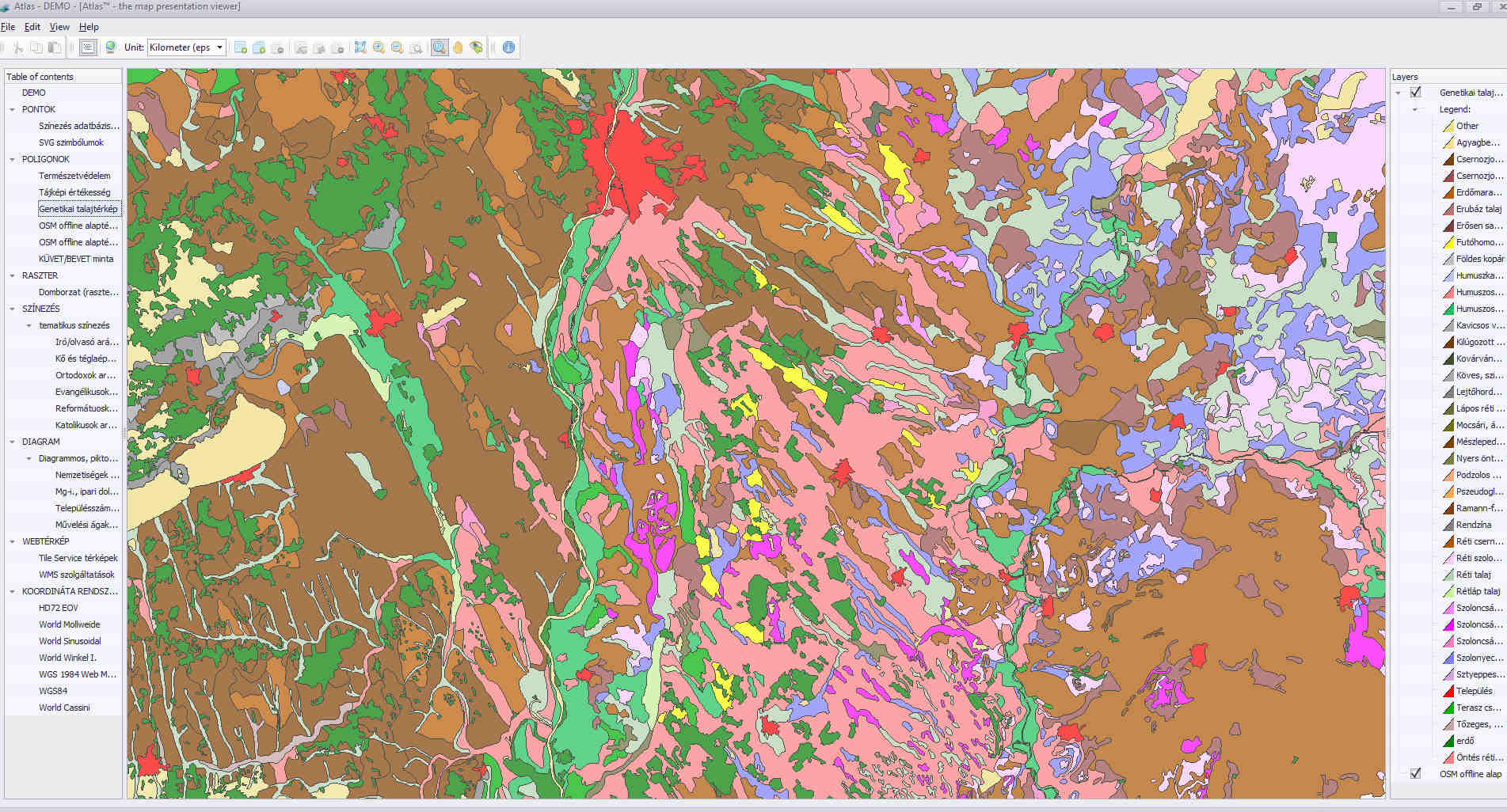
You can also create thematic maps with the software. You can view the source data for the map, in thematic colors, as a table or chart.
-
Scale-dependent display – For digital maps, it is common for layers with different details to be applied to zoom in / out with different colorations for zooming with different scales. You can set a separate aspect ratio based on layers.
-
The Atlas™ software does not require any installation or modification of the operating system files necessary for running machine. When the reader is inserted, the media can be started immediately.
-
The translated Atlas™ program can legitimately be reproduced free of charge, so you do not have to pay any extra fees.
-
In AtlasBuilder™, the Atlas™ to be created, can be tailored to the needs of the end user of the map, including Atlas.exe, version information, company name, file description, file version, legal copyright, and an ‘About’ window.
-
There are no limits to the maximum size of the maps.
-
Both AtlasBuilder™, and the generated Atlas™ are small systems (depending on the number and complexity of the layers in the map), so they can be used on computers running Windows XP (or later).